
Coventry, RI · the largest town in the smallest state
Two towns under one name.
Coventry covers about 62 square miles — bigger than any other town in Rhode Island. But the east half of Route 102 runs on public utilities and looks like a New England mill town. The west half runs on wells and OWTS and looks like Foster. We work both.
East Coventry
Anthony · Quidnick · Washington · Greene
The Pawtuxet South Branch villages. 19th-century mill cores, dense lots, public water from the Kent County Water Authority, and Coventry Sewer Authority sewer where lateral mains exist. Foundation work, sewer-tap and lateral replacement, and water-line trenching dominate the job mix here. It looks and works like the developed half of any New England valley.
West Coventry
Summit · Rice City · Big River edge
Cross Route 102 going west and the town flips: wooded ridges, glacial till, no public water, no public sewer. Every property is a well and an OWTS. The southern edge brushes the Big River Management Area, which adds a watershed layer to anything close to it. Long rural driveways and septic work are the daily job here.
What changes when you cross Route 102.
A Coventry estimate is really two estimates depending on which side of the dividing line your parcel sits on. Four practical differences:
EastKent County Water Authority for water in most of the village core; Coventry Sewer Authority for sewer where laterals exist (Anthony, Quidnick, parts of Washington).
WestNo public water, no public sewer. Every property is on a private well and an OWTS leach field permitted through RIDEM.
EastPawtuxet River South Branch valley — sandy loam, mill-era fill in places, occasional river-bottom silt close to the water.
WestGlacial till uplands, ledge outcrops, wooded ridges. The Big River reservation cuts through the southern end.
EastCoventry Building Department + Kent County WA / Coventry Sewer Authority for the tap. Town inspects.
WestRIDEM Office of Water Resources for any OWTS work. Town building official follows. Wetlands review more common.
EastSewer lateral replacement, water-line trenching, foundation digs in mill-era neighborhoods, basement egress, tight-lot site prep.
WestOWTS install + repair, well-line trenching, ledge removal on foundations, long rural driveways, land clearing.
West Coventry’s southern boundary touches the Big River Management Area — about 8,300 state-owned acres held by the RI Water Resources Board for future drinking-water supply. Parcels inside or adjacent get an extra layer of state review. We flag any West Coventry job that’s within about a half mile of the boundary so the design accounts for it early.
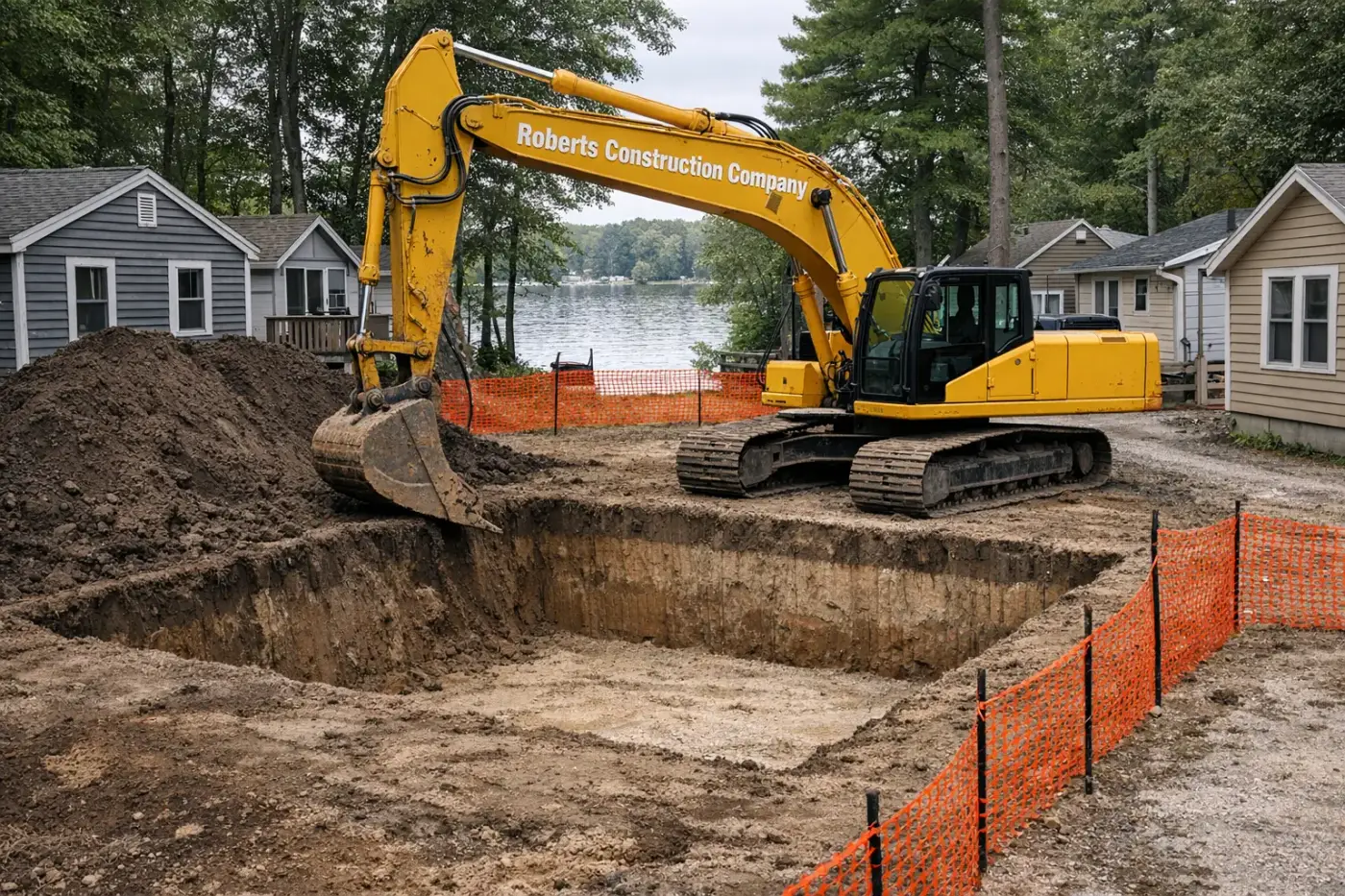
Excavation services we run in Coventry
Same trucks east of 102, same trucks west. Different jobs, same crew.
Septic & sewer
Foundations & structure
Drainage & water
Site, clearing & grading
Driveways, utilities & access
Frequently asked — Coventry
The five questions Coventry homeowners ask — suburban or rural.
- Is sewer or septic standard in Coventry?
- Depends which side of Route 102. East of 102 (Coventry Center, Tiogue, Anthony) most older neighborhoods are on Kent County Water and Coventry sewer. West of 102 (Greene, Summit, the rural western section) is overwhelmingly private well and septic. We check service maps before quoting any below-grade work.
- What's the work split east of 102 vs west?
- East of 102 is mostly suburban — sewer laterals, drainage retrofits, foundation repairs, tight-access trenching. West of 102 is rural — full septic installs, well coordination, recreational ponds, access drives, and farm-lot work. Same crew, same trucks; the equipment selection changes with the access.
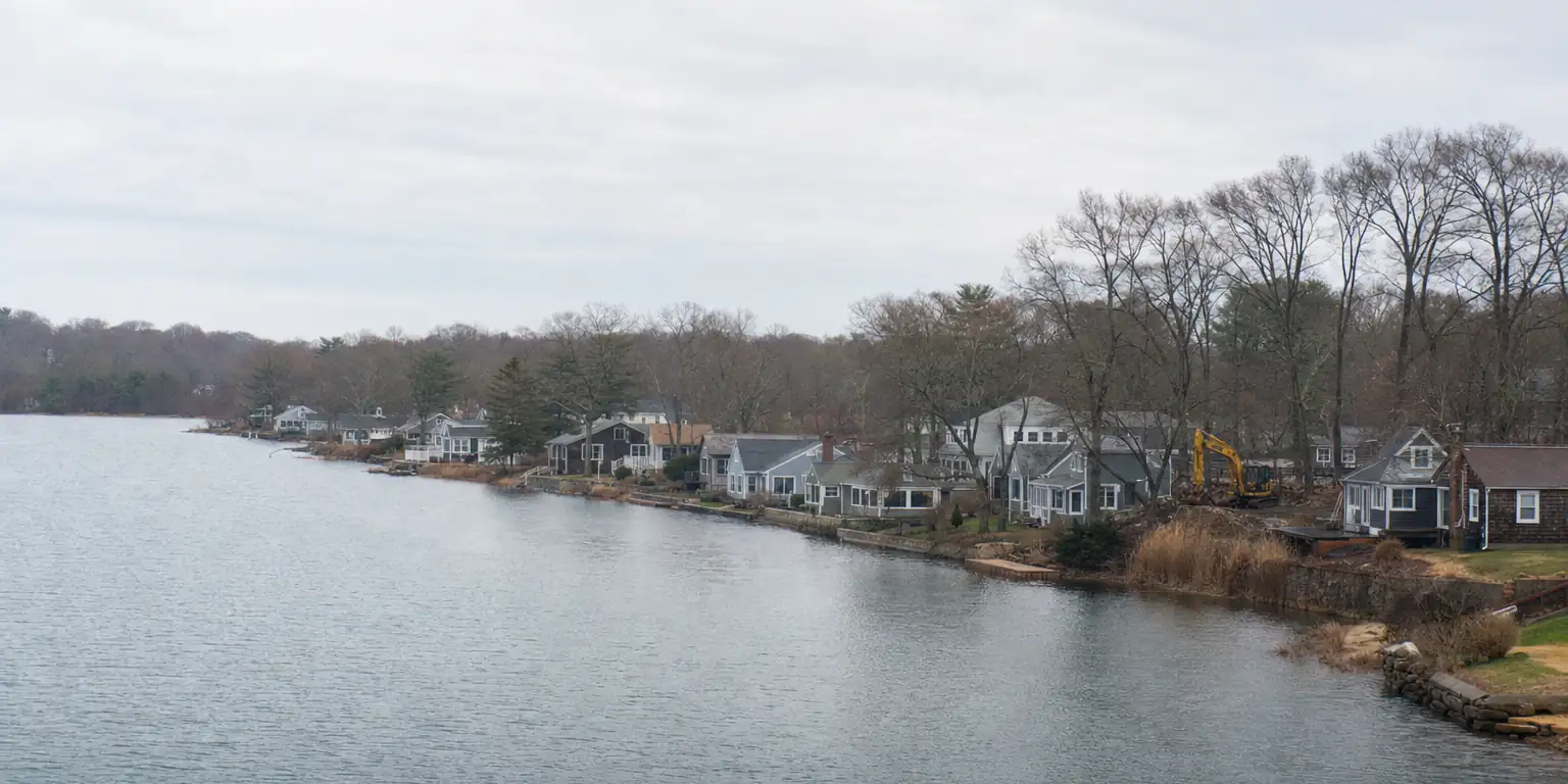
- Are there wetlands around Tiogue Lake?
- Yes. Tiogue Lake and its tributary streams are RIDEM-regulated, and Coventry Conservation Commission reviews work within 200 feet. Shoreline work on Tiogue itself needs RIDEM Freshwater Wetlands review and sometimes a structural permit. Setbacks for septic from the lake are larger than the standard 100 feet.
- Do you handle drainage on suburban Coventry subdivisions?
- Yes — drainage swales, catch-basin retrofits, French drains, and yard regrading are regular subdivision work. We coordinate with the Coventry Public Works on anything that ties into a town stormwater main, and we keep silt fence on any uphill slope through the season.
- Is Coventry's permitting process slower than CT's?
- Generally similar. RI's state-level OWTS permitting through RIDEM can run 30-60 days versus CT's NDDH at 14-30 days. Foundation and building permits at the town level are comparable. We build the RIDEM lead time into the schedule on new septic installs.
Tell us which Coventry you’re in.
Also in CoventryUnderground utilities Demolition