
Putnam, CT — On the Quinebaug
A river town reads from the river out.
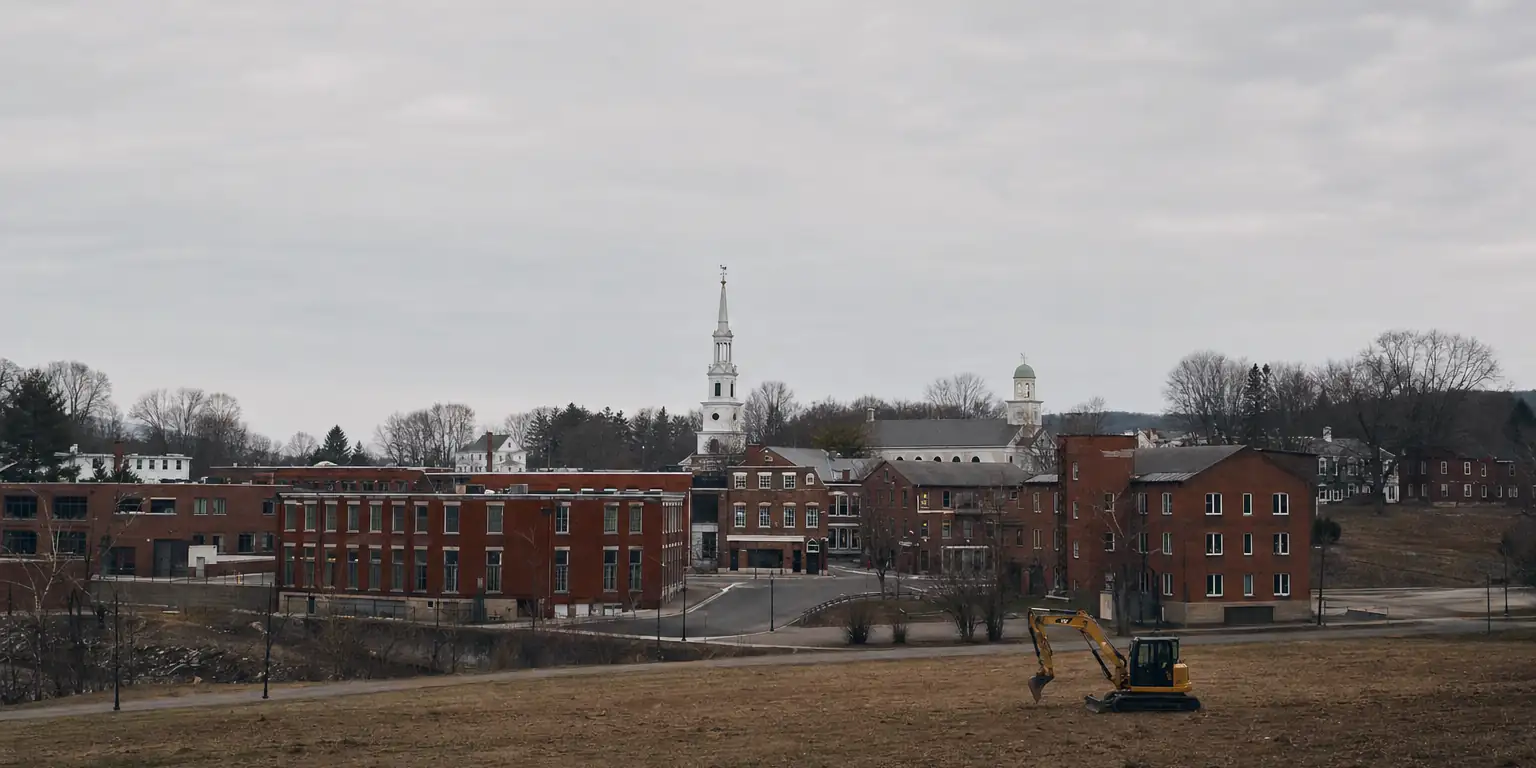
Putnam was built on the Quinebaug. The downtown still pulls up tight to the falls. The 1955 flood is still legible in the foundations. Excavation work here always starts with the river and works outward.
The river makes the town
Four moments that still shape every Putnam dig.
1727
Cargill Falls
Aspinwall Cargill harnesses the falls for a sawmill — the first thing that ever made Putnam matter. The downtown that grew up around the falls is the downtown that's still there today.
1855
Putnam separates from Pomfret + Killingly
By the time Putnam incorporates as a town, the river is doing the work — half a dozen mills along the falls, brick blocks pulling up tight to the banks. The lots that get built are the lots a Putnam excavator works on now.
1955
Hurricane Diane
Two hurricanes in eight days — Connie, then Diane — and the Quinebaug rises high enough to take out half of downtown Putnam. Buildings flood to second-floor ceilings; foundations move; basements never come back the same. Almost every sub-grade space we open in the brick downtown still shows a Diane line somewhere.
Today
Brick downtown + Putnam Heights
Two halves to the town from a working perspective: a tight river-valley downtown — public sewer, public water, narrow lots, mill-era foundations — and the residential ridges above (Putnam Heights, the Pomfret Road side) where lots open up, NDDH septic returns, and drainage is the everyday issue.
The work, downtown vs. the heights.
Two job profiles based on which side of the river-valley line your parcel sits on:
Downtown · river valley
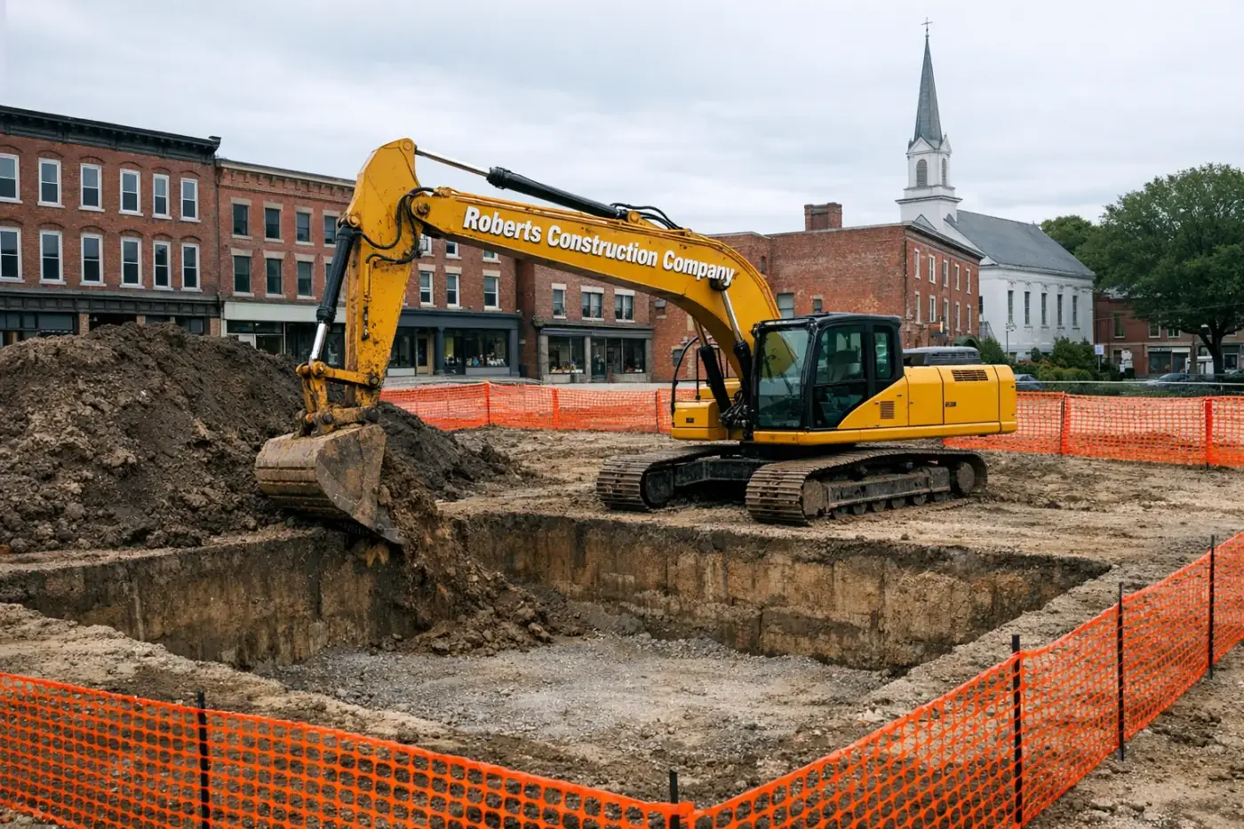
- Sewer-lateral & water-tap work on the brick blocks: the borough mains are old, the laterals are older.
- Antique-district basement repair: re-pointing rubble-stone foundations, regrading interior floors, fixing post-1955 settlement.
- Tight-access utility trenching in the alleys behind Main Street — careful, hand-finished where the equipment can’t fit.
Heights & outskirts
- NDDH septic — design, install, repair on the parcels outside the public-utility footprint.
- Foundation work on slopes: Putnam Heights drops fast toward the river, so retaining and drainage are part of every dig.
- Driveway & access work on the Pomfret / Thompson lines where lots open up.
Excavation services we run in Putnam
Putnam Center to the Heights — every scope below runs locally.
Septic & sewer
Foundations & structure
Drainage & water
Site, clearing & grading
Driveways, utilities & access
Frequently asked — Putnam
Five questions about excavating in downtown Putnam and the river-side parcels.
- Are foundations along the Quinebaug different from upland Putnam?
- Yes. Riverside parcels run softer alluvial silts and the Quinebaug's historic floodway shifts engineering — elevated foundations, base flood elevation compliance, sometimes engineered footings. Upland Putnam (the Heights, east-of-river neighborhoods) is closer to standard glacial till with intermittent ledge — more predictable cost.
- Can you work in Putnam's antiques district without disrupting businesses?
- We've staged most downtown work outside peak shopping hours — early starts, weekend cuts, off-season scheduling. Putnam's antiques district drives steady weekend foot traffic; we coordinate with the Downtown Putnam district and any affected merchants before mobilization, especially for trench work or anything that closes parking.
- What's the seasonal window for Putnam excavation?
- Year-round for foundation work and emergency repairs. November-March we slow planned new-construction excavation because frost depth and freeze-thaw on exposed cuts adds time and risk. Spring runoff (March-April) can push schedules on riverside parcels. Most Putnam excavation runs April-November for non-emergency new work.
- Does Putnam require historic review for downtown work?
- Putnam doesn't have a formal historic district commission, but the Downtown Putnam district and the antiques-district streetscape are taken seriously by the town. Below-grade work on private property is usually straightforward; anything affecting facade, street-front, or contributing structures gets a courtesy review by the Building Department and Mayor's office.
- How does Quinebaug flooding affect riverside lots?
- FEMA-mapped flood zones along the Quinebaug catch a meaningful slice of east-bank Putnam parcels. Elevation certificates, base-flood-elevation compliance, and floodproofing details are required for new construction in the SFHA. We pull current FIRMs before quoting and design the foundation to BFE+freeboard for any flood-zone lot.
The river still runs the town
Tell us where your parcel sits and we’ll tell you which Putnam you’re working in.
Also in PutnamUnderground utilities Demolition